Updated – 2/27/2015
Fixed compatibility with Python 3 for ArcGIS Pro
(If you’re using Firefox, then right click and Save Link As)
Download the Calculate Point Statistics Toolbox – works with ArcGIS 10.1+
View the Source Code
(any donations go towards hosting costs)
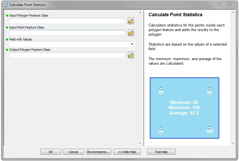
The Calculate Point Statistics tool takes an input Polygon and Point feature class and uses a selected field to find the minimum, maximum, and average of the points and adds the results to the polygon feature.
Be sure to view the Tool Help within the tool dialog box for detailed instructions. Also, check the Geoprocessing Results for any error messages.
Here’s a screenshot of the parameters:

I hope someone finds this tool useful. If you’d like this tool to calculate additional statistics for the points, let me know. Please leave a comment if you have any questions or problems, and be sure to check out the other tools I’ve created!


Hi Ian,
Thanks for providing the answer to my question on gis.stackexchange I really appreciate it. I wish I was more familiar with ArcPy so I could easily modify your code to generate min. values only and to extract as a point file. Would you see any use for this in your work? Let me know if you don’t mind modifying it, I’ll really appreciate it and I’d owe you one.
Thanks and keep up the good work
Yeah, I can definitely do that. The only part I’m unsure of is where the point that is kept for each polygon should be placed? Should I keep its current location or place it at the centroid of the polygon? If I place it at the centroid of the polygon, it may save you from needing to go back and snap it the line. What do you think?
Hello Ian
I m so appriciated for your scripts
Now I want to find minimum value for ueach polygon but write in to point file and keep thier location as it is is it possible? Please help me, thanks
Hi Mehmet Dagci, you might try asking on GIS Stackexchange – they should be able to help you there.
Ian, how would I go about adding the XY for the min and max points?
Hi Manuel, where exactly do you want to XY added? To the polygon?
Thanks for providing the Calculate Point Statistics Toolbox . It help me to come out my point mean value within polygon calculation problem it, I’ll really appreciate it and I’d owe you one.
Thanks and keep up the good work
Hi Suresh, thanks for the comment! I’m glad you found the tool useful.
hi i want to clip multple rasters then raster to point ,,such types tool if you have please share with me at s.goswami10@gmail.com
Thank you for this tool! It’s great!
Hi, Can I use it with QGIS ?
Thanks Ian,
I have long been searching for an option like this.
But, is there an option to use it in QGIS3 ?
Hi, Ian,
thanks a lot for your awesome tool.
Please let me know how I can keep in the output table a current location of a point (or initial point ID), for example, with MAX value?
Many thanks again.